And buses! And taxis! And other forms of transportation! I kept the title short because it was more catchy, but truthfully there are many different ways for humans to get around, but not all of them are a straightforward as one might think. Despite me trying to keep it brief, it ended up being a rather long post so I’m splitting it up.
I shall begin by giving an overview of most public transit systems, how to read their schedules and their routes since most Americans haven’t used public transit much in their lives if ever. A byproduct of the post-WW II infrastructure bills was an increase of car usage and a decline of public transit. I won’t go into all the politics involved or discuss the lobbies by the car manufactures because it’s not exactly relevant here, but it’s a fascinating history that is well worth the investigation for my more academically mined readers. As politics and history aren’t exactly within the scope of this blog, we shall simply acknowledge the reality that in America the car is king and so many haven’t had much experience with public transit.
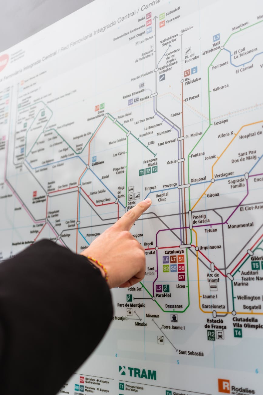
We’ll start with subway and train maps for most cities. They can be a bit deceptive in that the inventor of this system made them for ease of reading for stops and connections not to show how far apart those stops and connections were nor all the twists and turns of how to get there in reference to any specific direction. Just because it reads left to right doesn’t mean that a line is going precisely east to west, it could go in a general northeast to southwest direction or a northwest to southeast direction. Nor are the stations in a precise line, they may be quite staggered all over the city but be represented in a straight line. Once you understand that, it becomes much easier to understand what you’re looking at and to connect a city map to a subway map. It’s actually quite intuitive once you understand that.
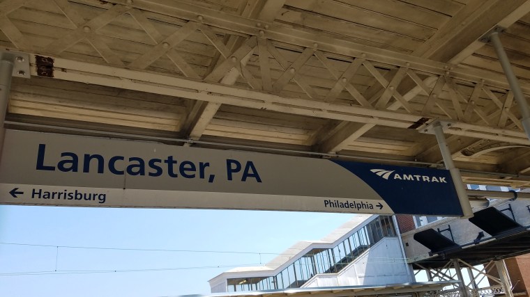
Most subway and train platforms will show you which side leads to which direction. Many subways will have signs that start at the station you are at and show you all the stops until the line terminates in one direction and then have another sign that shows you all the stops until the line terminates in the other direction with helpful arrows pointing to which side of the platform corresponds to which part of the line. It’s actually rather intuitive. Now occasionally a line will branch further down or a platform will service multiple lines. To eliminate the guess work, simply look at the electronic signage typically above the platform that will usually display something helpful like “train to X stop in y minutes” (usually where the line will terminate), look at the list of stops on the sign and you can easily see which train is coming in. You will notice that I also added that these signs will often have the number of minutes you’ll be waiting. For most subways, the lines run every 10 or so minutes so there’s no need to rush to try and catch a subway car since they run quite frequently.
Once you’re on the subway or train, there is usually electronic signage indicating what stop is coming next. If not, then there is usually an announcement that comes on and you’ll often see signage outside the windows as you’re coming into a station to indicate where you are. Typically, all three indicators are present, which makes it quite easy to know what stop you’re arriving in.
Now to figure out which stop you need, you’ll often have to consult a city map for the various landmarks you wish to see and then look to see what the nearest station will be. You may need to transfer to different lines depending on your stay. You should also make sure you know how late various lines run as not every line may run 24 hours a day and you should be certain to check their websites for the most accurate and up-to-date information. Don’t assume because your friend did it a month ago that it hasn’t changed. Staffing shortages and weather can cause last minute issues. You don’t want to be caught in the middle of the night in the pouring rain miles from your hotel.

The subway is my favorite public transit because of its ease of use and simplicity. Most subways will pop you out within a five to ten minute walk of most landmarks and many subways have helpful signage pointing you in the general direction of those landmarks. I do recommend purchasing those city maps at local stations rather than simply relying on your phone as the maps are made for tourists. They often have the lists of the most popular sites along with an indicator of where on the map they are which can help you plan your trip, cluster sights together and potentially discover lesser known attractions that are tucked alongside bigger ones. These maps can also indicate lesser known entrances for popular destinations to help avoid crowds. For example did you know the Louvre has several entrances and you can avoid longer lines by using them rather than the main one?
You may need to purchase a subway card, tickets or simply use your credit card to tap and go. Every city is different so look up what you’ll need before you go. Some cities even have specific apps for their public transit system which can be quite helpful when trying to figure out routes. While google maps may be helpful, it won’t necessarily show you which stops are handicapped accessible if you’re traveling with someone who has limited mobility, their app will.
Now, I’m not as much of a fan as the bus, but I will say that they do tend to help close the gaps of the subway stations, especially when not every subway is handicapped accessible and in many of the smaller towns and villages the bus is your only option. I have not found the bus system to be as straight forward and easy to read as the subway nor are the systems employed by the various cities as universal as the subway. I have found that once you master the subway system in one city, it translates exceedingly well to other cities. Not so with the buses. The bus stops don’t always post bus schedules, they don’t always indicate where the bus is going, you may not realize that multiple lines stop at the same place. Often the maps provided will show where each line goes and won’t give you a nice neat way of seeing connecting lines like a subway. Now, this isn’t the case for every city, some are really good, others not so much. So make sure you research before you go and try to have a good idea of how to get around with the bus system before arriving at your destination. Just like with the subway system paying for the ride will be dependent on the city you’re using so be ready to purchase a card, ticket or to tap your credit/debit card. Just know that if you choose to tap your credit/debit card you may incur overseas processing fees depending on the type of card you have, so check with your bank prior to your travels and see if you qualify for a card that will forgo those fees.
Additionally, there are different sorts of buses, the buses within a city and the buses that traverse between major hubs. Buses within cities tend to follow similar rules as the subway. The buses between cities and major hubs may include things like a hold below for your luggage. These also tend to be a little more comfortable than the usual city bus as they’re made for longer trips. These buses have less stops but travel further. Be sure to bring both card and cash with you for the trip as sometimes they will only take one or the other depending on where you’re traveling.

In some cities, there is even a public boating system that will ferry you down the main river going through the city. Be sure to check out that potential if visiting a place with a larger river running through it like London.
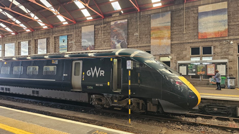
Now if you’re traveling a longer distance, you may find yourself opting to travel by train usually because the airport isn’t the same place as your destination. Much like every other mode of public transit, it can vary vastly by country and even region as you may have a regional rail that you take, a national rail or a combination of the two. Typically taking a regional rail will mean more stops and thus slower whereas a national rail will be faster with fewer stops. Train stations can serve both national and regional rails. Regional rails tend to be cheaper than national, so when you’re booking tickets be certain to compare. Yes, the regional rail may be vastly cheaper, but you may lose an entire day of travel on a train rather than half a day if you take the national.
I advise purchasing tickets ahead of time as same day tickets tend to be more expensive. Now there are some systems in which different windows of time prior to the travel date affects the price of the ticket, so it may actually be better to wait a week or two for the optimal time when making your purchases. Some countries have rail passes which may be better to purchase. It is sometimes better to purchase your tickets directly through the rail system other times a 3rd party website can help you get the best deal by splitting the ticket for you. A split ticket, is when you pay for a ticket to a city between your start and end point and then pay for another ticket from that city to your end point which can save you money depending on how the fares work out.
Now this can be a bit of a trick as some train systems have windows of time where train tickets are cheaper, and same day tickets are usually the most expensive, so it’s better to purchase tickets in advance. This can be tricky if you’re unsure of the timing for flights, arrival and customs. However, this stress can be alleviated by purchasing flex-time tickets if they’re available for that train system. Flex-time tickets is fairly self-explanatory, it allows you to “flex” the time you take the train, so if your flight is delayed or your luggage took forever to arrive at the carousel, you needn’t worry about missing your train, as you can catch the next one, they are a more expensive option, but it’s still less expensive than purchasing a same day ticket or having to purchase multiple. Sometimes peace of mind is worth the extra cash. Many rail systems allow you to reserve your seats. If you’re someone prone to motion sickness, be certain to get a seat facing the front of the train. Personally, I like getting a seat with a table so I can spread out, work on a puzzle book, read, journal and relax. It also gives me a nice place to rest my head comfortably.
The best way to know what to do is to research the country’s train system that you’re going to since every rail system is going to be different, but there are usually ways to save money when taking the train with some foresight and careful planning.